|
|
 |
CemMap Cemetery Mapping has been important
part of Legacy Mark’s product line for many years.
It is a true Geographical Information Systems (GIS) mapping system
that is customized for the cemetery industry and that has been built
upon the industry leader in end-user GIS development systems. It is
packed with all the power of GIS mapping with only the features that
you need to run your cemetery. Other systems make you pay for a full-featured
GIS system when you only will use a few specific features. Not CemMap.
It has been specially designed with the help of cemeterians to have
all the tools you will need and nothing else. That is, you get all
the benefits and you only pay for what you need and use in a cemetery.
We proudly offer the best mapping solution for cemeteries.
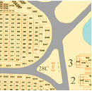
GIS is ideal for cemeteries because they combine a high quality, accurate
on-screen map with a database. That means that you can view a grave
on the screen, know it’s status by its color code, read the owner/occupant
name right on the grave and click on it to see more data. It is an
ideal tool to help you manage your cemetery.
 |
| Mapping
Layout 1 |
click to
view large - view
all |
| |
 |
| Mapping
Layout 2 |
|
General CemMap© Mapping Features
- Supports Single workstation and multi-user
network installations.
- Industry Standard and Customer Specified language,
icons and themes are used throughout the mapping system so users
are familiar and comfortable with the system quickly.
- CemMap Cemetery Mapping is a pure Windows application
with familiar Windows menus and screens, which makes it fast and
easy to learn.
- Single Point of Entry for data. The map collects
its information from the Cemetery Office Management system, so
any entries or change made will be updated on the map automatically.
CemMap© Cemetery Mapping Specific Features
- CemMap Cemetery Maps detail all of the features
of the client’s cemetery and track data to each item. All
roads, paths, monuments, sections, blocks, lots, graves and buildings
are digitized and electrical, water, drainage, etc can be added.
- Mausoleums, niches & columbariums are detailed
with the same precision and flexibility of in-ground spaces.
- Locate Clients on the mapping system by simply
clicking a button! The client’s graves are highlighted and
the system zooms right in on these graves.
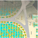
- Every Space on the map is color-coded based
on its status: for sale, sold, and occupied. You can look at your
cemetery on screen and immediately know the status of every grave
by its color code
- Inventory Management (Sales) is greatly enhanced
by the color coding of the grave spaces. The green graves are
for sale, it’s that simple! Review availability before you
walk the grounds.
- Measure right on your maps (see right)
What Do We Do?
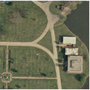
- Legacy Mark starts with Hi-Resolution Satellite
images of your cemetery and builds your map system using your
paper maps, CAD files, Raster images or plot plans. Merging the
Satellite information with your existing details produces a better
map with better information in a superior digital format.
- Legacy Mark Can Create a Map of your cemetery
with our GPS digitizing and data collection service. Our technicians
will come to your cemetery, locate the headstones with hi-res
GPS equipment, collect the information from the headstone, and
produce a final map system with your headstones accurately located
and the data already implemented. You just start using the system
the day it is delivered.
- Add New Sections and/or Graves at any time.
Send us your details or ask us to design for you.
- Print Maps for your office wall or your daily
use on paper or durable vinyl in any size and detail you would
like.
|
 |
| |
|
|
| |
|
|
 |
|


